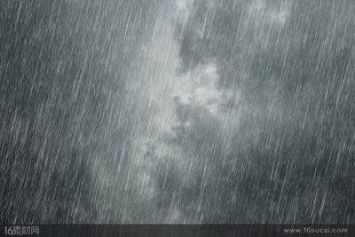
Heavy rain (English name torrentialrain; rainstorm; storm) refers to the precipitation intensity of the rain, often formed in the cumulonimbus. China's weather, the daily rainfall of 16 mm or more, or 12 hours of continuous rainfall of 30 mm above the 24-hour precipitation of 50 mm or more of the rain called "rain."
According to the size of its precipitation is divided into three levels, that is, 24 hours precipitation for the 50-99.9 mm called "rain", 100-249.9 mm between the "heavy rain", 250 mm or more called "heavy rain." But because of the different precipitation and terrain characteristics, so the storm floods around the standard is also different.
The process of rainstorm formation is quite complex. Generally, from the macroscopic physical conditions, the main physical condition of the rainstorm is the steady flow of water vapor, the strong and persistent upward movement of the air and the instability of the atmosphere structure. Large and medium scale weather systems and the underlying surface, especially the favorable combination of terrain can produce greater rainstorms.
The weather system that causes large-scale heavy rain in China is mainly front, cyclone, shear line, low vortex, trough, typhoon, east wind wave and tropical convergence zone. In addition, in the arid and semi-arid areas of thermal thunderstorms can also cause a short period of time, a small area of heavy rain.
Heavy rain is often falling from the cumulonimbus. The formation of cumulonimbus conditions is the atmosphere to contain sufficient water vapor, and a strong upward movement, the rapid upward transport of water vapor, the water droplets by the rising movement of the impact of increasing, until the rising air hold, Drastically landed on the ground.
Rainstorms generally occur in small and medium scale weather systems with a time scale ranging from tens of minutes to ten hours, with a scale of several kilometers to several hundred kilometers, while small and medium-sized systems that generate heavy rain are in the weather scale system. People usually have a close relationship. Thus the collection of two types of weather systems is called the precipitation system.
The formation and intensity of precipitation in the precipitation system are mainly related to the six conditions:
(1) Water vapor distribution and supply
In order to make the rainstorm happen, develop and maintain, there must be abundant water vapor supply. The calculation shows that it is not enough to rely solely on the moisture contained in the column of the precipitation area. Even if the water vapor contained in the air column can only reach 50 ~ 70mm of precipitation. But the precipitation of heavy rain, especially heavy rain or heavy rain is very strong precipitation, up to 100mm per hour, and therefore must have external water vapor to the storm area quickly concentrated and constantly supply. For persistent rainstorms, water vapor is required to continue to deliver in order to supplement the amount of water vapor that continues to be consumed by heavy rains. This water vapor transport requires a particularly effective mechanism to collect the rainstorm in a much shorter period of time The amount of water vapor.
(2) Upward movement
Precipitation is occurring in the ascending motion area of the air, and the ground or lower air can only reach saturation by uplift, resulting in condensation and falling into precipitation. For the weather scale (such as front, temperate cyclone, high tank front, subtropical high pressure edge, etc.) rise speed is only 100cm / s. The precipitation caused by this rise is about 100 to 101 mm / 24h. Therefore, the rising motion in the large-scale system can not cause heavy rain, and in fact rarely observed thousands of kilometers of rainstorms, in the horizontal scale of 100 ~ 300km mesoscale system (such as mesoscale convergence line, squall Line, mesoscale low voltage, etc.) rise speed than the large scale system in the ascending speed of an order of magnitude, reaching 101cm / s. The precipitation caused by this ascending motion is about 101 mm / h, reaching the intensity of the storm. For the cumulus scale small scale system, because of its rising speed up to 102cm / s, the resulting precipitation intensity of about 102mm / h, reached the magnitude of heavy rain. Thus in different scales of the weather system, with the direct rainstorm is related to the small scale up movement, so small and medium scale system is a direct rainstorm caused by the weather system. However, the large-scale rising motion provides the necessary circulation background and environmental conditions for the formation and enhancement of the small-scale uplift movement. Therefore, the existence of large-scale ascending motion is a prerequisite for the development of heavy rain.
(3) Layered stability and mesoscale instability
Convective rain is a hot convection phenomenon. There are two types of convection in the atmosphere: vertical convection and oblique convection. The vertical convection and the oblique convection are not exactly the same in physical condition. The former mainly depends on the stability of the atmosphere, and the latter must consider the dynamic instability condition in addition to the stability condition.
(4) vertical shear of the wind
The vertical shear of the wind has a more important impact on the strong storms. It is also one of the important factors that affect the heavy rain due to the heavy storms, especially the sudden heavy rain.
(5) cloud of micro-physical process
Due to the interaction between terrain and different scales of weather systems or cloud systems, natural sowing processes can be formed, thereby increasing precipitation and creating heavy rain. Due to the role of terrain, in the piedmont before the formation of a wide range of layered clouds, which have many small raindrops, if the cumulonimbus from the sea or other areas into this layer of cloud area, can form cumulonimbus and layered cloud coexistence Mixed cloud system, two kinds of clouds of different sizes of raindrops will be a clear interaction between the sowing process. The strong ascending airflow in the front of the cumulonimbus will carry one of the heavy rains upwards, convert it into ice crystals or snow crystals through the 0 ° C layer, and some become supercooled water droplets. Since the saturated vapor pressure of the ice is less than that of the water droplets Water vapor pressure, celestial rain in the water vapor will be condensed to the ice crystal, so that the growth of ice crystals, due to the accumulation of water in the upper part of the accumulation of water, supercooled water droplets will evaporate to add water vapor, the result of the cold water droplets into the rapid transformation of ice Species instability is also known as glue instability). Part of the large ice crystals grown in this way is brought to the cloud anvil with the ascending airflow, where it falls, passes through the zero layer and becomes a large drop of water, and then falls into the low-lying stratiform clouds to capture the suspended A large number of small water droplets and growth, and finally fell to the ground to become heavy precipitation. The other part of the ice above the cumulonimbus is followed by the subsidence of the subsidence directly into the stratiform cloud, through the process of rapid growth to large raindrops, but also to increase the ground precipitation, this mixed cloud not only in the coastal areas of the mountain It can be observed that during the rainy season, the typhoon season is also often observed, it makes the precipitation increase the formation of heavy rain.

(6) terrain
Heavy rain is closely related to terrain. In summer, the distribution of daily frequency and rainfall distribution in different regions of China are affected by terrain of different scales. The large-scale terrain of our country is in the east and west, and there are east-west mountains (Yanshan, Nanling, etc.). Monsoon and the southwest monsoon, the humid air uplift by terrain, the largest number of stormy areas are mostly located in the eastern or south of the mountain windward slope, such as the Taihang Mountains, Funiu Mountain, Dabie Mountain, Wuyi Mountain and Yanshan and Nanling Mountains. For the regional or local scale rainstorm, the rainfall distribution is also closely related with the terrain, such as Beijing is located in the northern part of the North China Plain, which is the northern part of the Yanshan Mountains, the western part of the northern mountains, the two mountains in the northwest of Beijing In the southwest is the plains, due to the impact of terrain, the largest number of summer rainstorms in the west and north slope of the hillside, here is the lower side of the southerly winds or easterly winds, the air has a significant uplift and terrain caused by Shear convergence line.
Comment list ( 0 )

