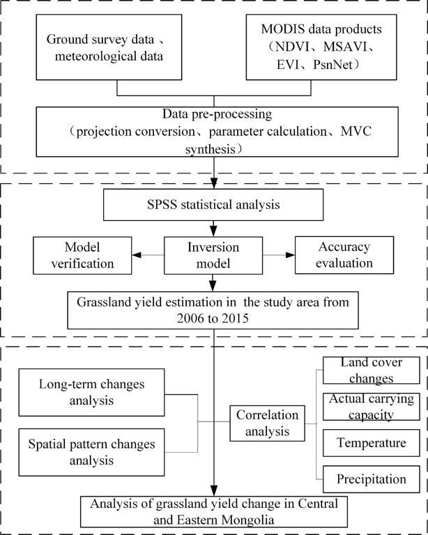
Multi-source data such as ground survey data, long-term remote sensing data, and meteorological data were obtained, and data pre-processing including projection conversion, parameter calculation, and MVC maximum synthesis were performed based on MRT and ArcGIS tools. Then, we established multiple grassland yield estimation models by using SPSS statistical analysis method, and the optimal model was selected through model verification and accuracy evaluation. Finally, based on the optimal inversion model, the spatial-temporal distribution of grassland yield from 2006 to 2015 was obtained year by year.

Comment list ( 0 )
