Landslide disasters have characteristics of frequent occurrence, widespread impact, and high destructiveness, posing serious threats to human lives, property, and the ecological environment. Timely and accurate early identification of landslides remains an urgent issue within the disaster prevention field. This study focuses on Jianzha County, Qinghai Province, integrating PS-InSAR, SBAS-InSAR, and optical remote-sensing techniques to delineate potential landslide-prone areas. Utilizing Google Earth imagery and existing landslide datasets, potential landslide points were identified through a deep learning model. Results indicate the following: (1) In Jianzha County, the variation trend of the average surface velocity monitored by PS-InSAR and SBAS-InSAR technology is consistent, and the deformation monitoring results are reliable. (2) Utilizing the deep learning model, 56 potential landslide points were identified, comprising 39 high-risk points and 17 medium-risk points. By integrating the spatial distribution data of historical geological disaster points, 10 out of 13 previously occurred landslide disaster points were found to be located at the identified high-risk landslide points, achieving a detection accuracy of 76.92%. (3) The spatial distribution of landslide points exhibits clustering, with slopes ranging from 10° to 40°, elevations between 15 and 30 m, and slope orientations predominantly toward the northeast. (4) Landslide formation is correlated with seasonal precipitation concentrations and temperature fluctuations. This method can provide a crucial basis for large-scale surface deformation monitoring and early identification of landslide risks.
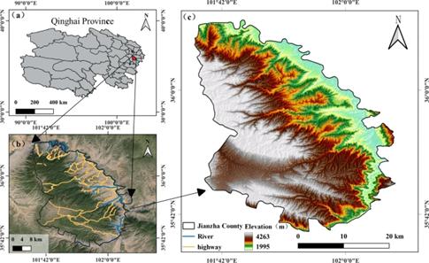
Geological hazards such as landslides occur frequently in Jianzha County, Qinghai Province, severely impacting the ecological environment and social stability. Consequently, landslides must be promptly and accurately identified early, and effective preventive and responsive measures should be implemented. Owing to various inducing factors of landslide disasters, such as river scouring, heavy rainfall, earthquake, human activities, and so on, it will not only cause serious casualties, property losses, traffic interruption, environmental damage, and other direct hazards but also produce secondary disasters such as debris flow and dammed lake1, which highly restricts the development and utilization of resources. Landslides are characterized by sudden onset, high difficulty of management, and frequent occurrences in groups, all of which complicate the early identification of landslide hazards. Timely, accurate, and efficient early identification of mountain landslides has become a pressing issue in the field of disaster prevention.
Field surveys and regular updates of landslide inventory maps are conventional methods for investigating potential landslides. However, relying solely on traditional manual field surveys or expert interpretation introduces subjective biases and consumes considerable resources. Radar data exhibit features of continuous operation, all-weather capability, and high precision. Research has illustrated their expansive application prospects and growth potential in surface deformation detection. While machine learning methods are widely applied in landslide modeling owing to their simplicity and strong interpretability, their limited capability to explore correlations between input variables hampers their ability to extract deep features from the data. Furthermore, these models lack the autonomy to perform feature learning. Different from traditional machine learning methods, Convolutional Neural Networks (CNNs) are machine learning model containing multiple convolution layers and pooling layers, which reflect the structure of human brain neural network.
Currently, identifying landslide disasters through intelligent means has become a prevailing trend. However, research scarcely focuses on using deep learning networks to identify landslides by combining InSAR technology and optical remote-sensing technology. Leveraging multi-source databases and intelligent methods is crucial to construct high-precision models tailored for potential landslide disaster identification in this region, thereby enabling the intelligent identification of large-scale landslide distribution.
This study, grounded in terrain visibility analysis, aims to integrate PS-InSAR, SBAS-InSAR, and optical remote-sensing technologies to delineate potential landslide areas. Subsequently, by employing Google imagery in conjunction with deep learning models, it seeks to identify potential landslide points. Finally, the study integrates terrain, precipitation, and temperature data to analyze the distribution patterns and underlying causes of landslide development. This research provides novel approaches for the large-scale, automated early identification of mountain landslides and landslide susceptibility mapping, largely contributing to disaster prevention and mitigation efforts.
Sources:
Scientific Reports
https://www.nature.com/articles/s41598-024-72391-2#Sec1 .
Provided by the IKCEST Disaster Risk Reduction Knowledge Service System
Comment list ( 0 )

