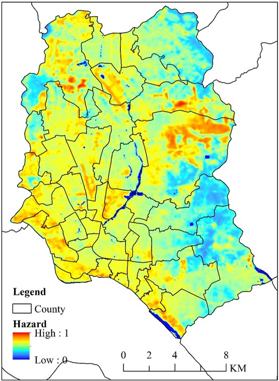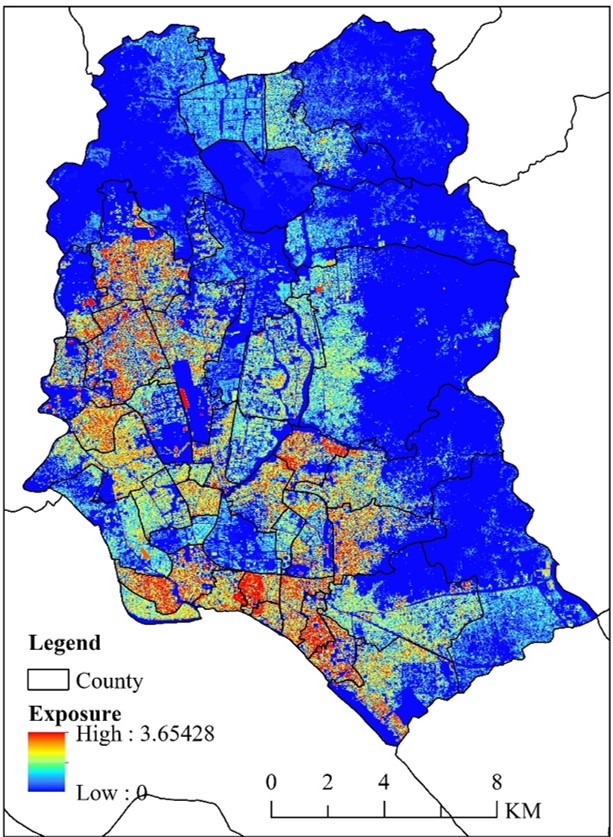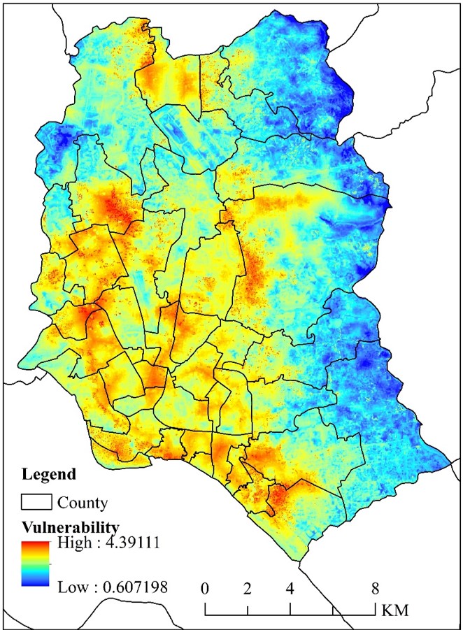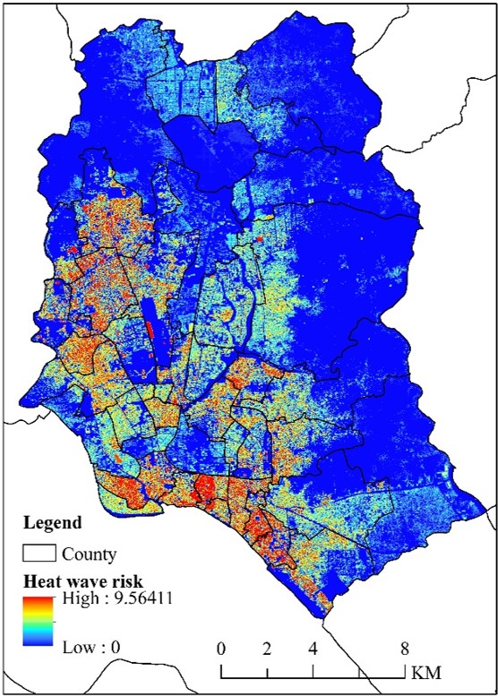

South Asia is the region controlled by heat wave in the world where Bangladesh located. This knowledge application takes Dhaka City in Bangladesh, as a typical area to carry out multi-scale assessment of heat wave hazard. By clicking and zooming, users can intuitively and conveniently understand the heat wave risk, exposure, vulnerability and risk of Dhaka, at km, 100m and 10m scales. The dataset consists of heat wave hazard, exposure, disaster prevention and mitigation capability and risk assessment in Dhaka, Bangladesh. Its hazard was calculated from the Land surface temperature. Its exposure was evaluated by night light data, population density, population aged over 65 and less than 5, and the number of people without self-care ability. Its ability of disaster prevention and reduction was calculated with NDVI, distance from hospital, water body, and road, the proportion of impervious layer area and the slum area. The dataset was built based on the heatwave risk that assessed on the risk, exposure and the ability of disaster prevention and reduction. The data used in this knowledge includes meteorological data, basic geographic data, population economic data, remote sensing data, etc. Population data comes from SEDAC, basic data such as roads and hospital distribution come from OpenStreet, night lights come from "Luojia No. 1", and weather data comes from World Meteorological Data Center, remote sensing data comes from the USGS website, etc. The spatial range is Dhaka, Bangladesh, with a spatial resolution of 1000 meters, 100 meters and 30 meters. The application of this knowledge was completed by the Institute of Geographical Sciences and Natural Resources Research of the Chinese Academy of Sciences. It realized the sorting and archiving of data in Dhaka, Bangladesh, a typical South Asian region, and completed the risk of high temperature heat waves at the three scales of 1 km, 100 m and 30 m in this area. Analysing the exposure, vulnerability and risk, mastering the overall spatial law of high-temperature heat waves, and identifying key areas of high-temperature heat waves can provide data support for regional disaster prevention and avoidance, and accurately indicate the risks of high-temperature heat waves on the street scale, which is helpful for governments, enterprises, and residents to provide scientific basis for disaster reduction and avoidance.