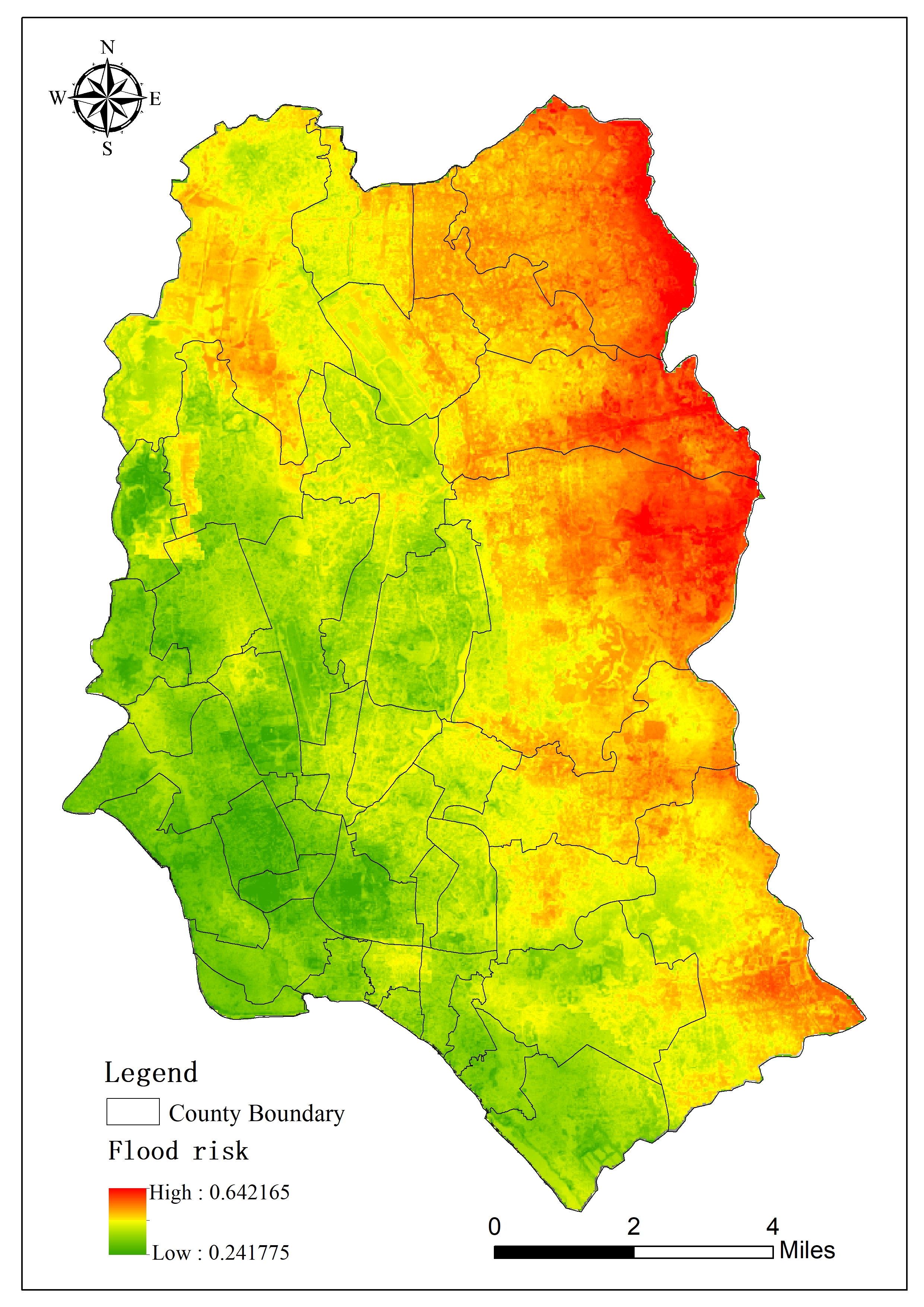
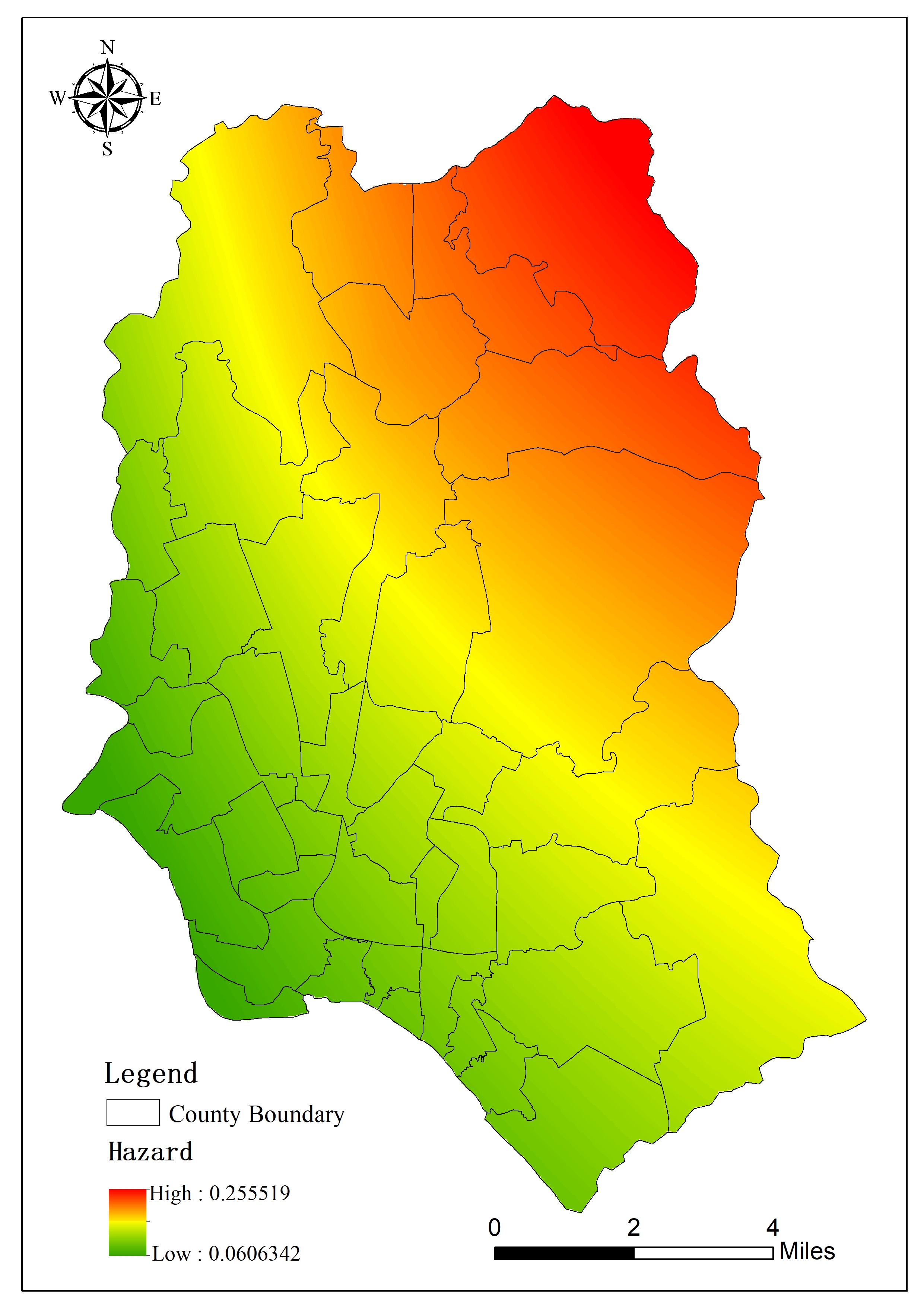
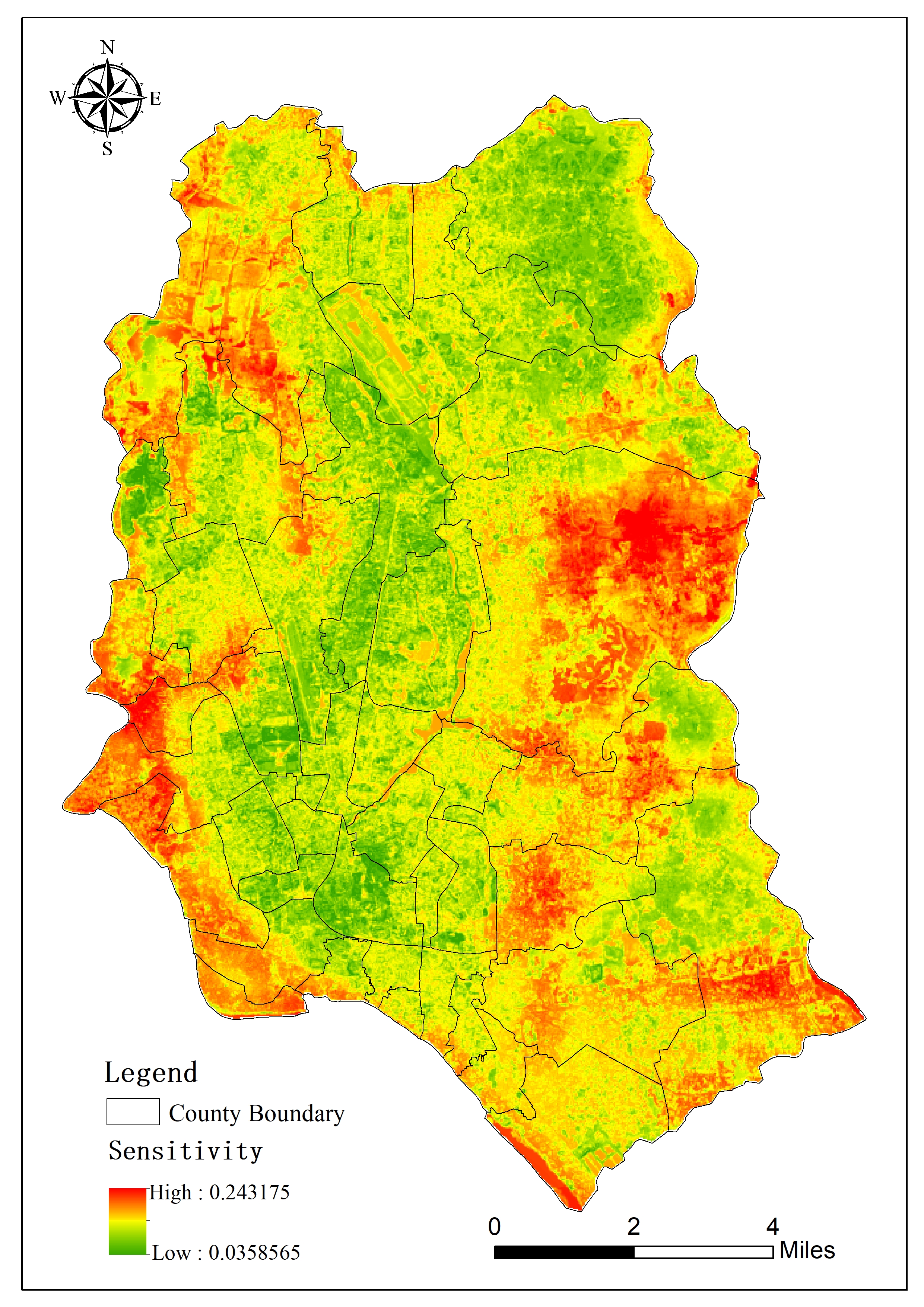
Flood disaster is one of the important natural disasters faced by Dhaka and its surrounding areas. Due to the special geographical location and climatic conditions, the area often faces the threat of floods and waterlogging during the monsoon season, which poses a great threat to the safety of residents' lives and property and the sustainability of the city. The development brings huge challenges. This knowledge application collects basic geographical information, meteorological data, socioeconomic data, etc. of Dhaka City, and organizes and processes them to establish the data sets required for research. According to the characteristics and influencing factors of flood disasters, a total of 12 evaluation indicators were selected from three aspects: risk, sensitivity, and vulnerability. The weight of each evaluation indicator was determined through expert consultation and fuzzy analytic hierarchy process, and the comprehensive evaluation method was used. The comprehensive weight of each indicator was calculated, and GIS tools were used to implement flood disaster risk assessment in Dhaka City, and flood disaster risk distribution data at a resolution of 30 meters was obtained. Through the multi-index comprehensive evaluation method, we can comprehensively understand the risk level and impact scope of flood disasters, provide the scientific basis for decision-makers, promote the sustainable development of cities, and reduce losses caused by flood disasters. At the same time, the disclosure of assessment results and public participation can also improve the public's risk awareness and enhance society's overall response capabilities.
 |
 |
 |
 |

