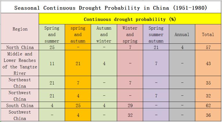
China's drought disaster distribution and seasonal drought area.
Drought
Usually refers to the period of a year or almost complete lack of rain. Due to different definitions and actual production requirements, the length of dry season varies greatly, generally referring to dry season in other periods than rainy season. In order to describe the severity of drought, the ratio of annual (seasonal) precipitation to normal (seasonal) precipitation or annual evaporation to annual precipitation is usually used as the target. The severity of drought can be divided into five levels: extreme drought, severe drought, moderate drought, light drought and slight drought.

Comment list ( 0 )
