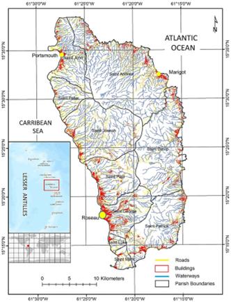
Hurricanes can trigger widespread landslides and flooding creating compound hazards and multiple risks for vulnerable populations. An example is the island of Dominica in the Caribbean, where the population lives predominantly along the coast close to sea level and is subject to storm surge, with steep topography rising behind, with a propensity for landslides and flash river flooding. The simultaneous occurrence of the multiple hazards amplifies their impacts and couples with physical and social vulnerabilities to threaten lives, livelihoods, and the environment. Neglecting compound hazards underestimates overall risk.
Climate change is exposing communities in the Caribbean to some increased impacts of extreme weather and sea level rise. The region witnessed a faster rise of 3.6 mm/year in sea level than the global average (3.3 mm/year) between 1993 and 202089. The impact of the rising sea level through coastal erosion and flooding, as well as the frequency of intense hurricanes accompanied by severe rainfall and high storm surges with a tendency to intrude deep into the populated areas, are likely to increase in the future.
Dominica is repeatedly impacted by hurricanes and tropical storms. The accompanying rainfall often causes landslides and flooding; as a result, the island state experiences compound and cascading effects of multiple hazards. This study demonstrated the implementation of an integrated framework for a multi-hazard risk assessment covering hurricanes and induced landslides and floods together. The analysis was performed at two spatial scales; Level-I analysis projected and quantified multi-hazard susceptibilities and identified the at-risk population, whereas the level-II assessment produced detailed and diverse scenarios of the selected hazards at specific locations with the application of high-resolution data and simulation models. The interviews and participatory workshops provided valuable insights into how risk from various hazards is perceived and prioritised by local experts and people.
The results of this analysis could be improved by interrogating more the consequence of the assumptions made for the analysis as well as including further hazards not considered here. This research shows there is still work to be done on investigating the relevance and acceptability of hazard zoning, land use planning, building and planning regulations, and infrastructure relocation to reduce the identified risks. One possible entry point for determining the viability of these approaches is the strongly expressed community support for improving infrastructure and services. Emphasizing and enacting multi-hazard risk assessment studies, which draw on local expert and community knowledge and opinions, such as the present one, can play an important role in devising effective DRR policies and practices for Dominica and SIDS with similar challenges in the Caribbean.
Sources:
Nature scientific reports
https://www.nature.com/articles/s41598-023-47527-5#Sec22 .
Provided by the IKCEST Disaster Risk Reduction Knowledge Service System
Comment list ( 0 )

