It is located in northeast Africa, bordering on the Republic of Sudan in the west, Ethiopia and Djibouti in the south, facing Saudi Arabia and Yemen across the Red Sea in the East, and blocking the entrance of the Red Sea into and out of the Indian Ocean, the location is very important. The national coastline is 1200 kilometers long.
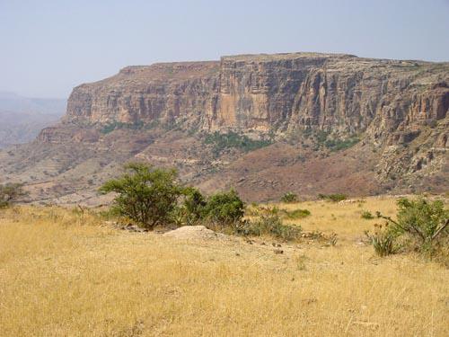
Eritrean terrain is mainly plateau and plain. The eastern plain inclines gently from northwest to Southeast. The Mareb River is the largest river. The plateau area has a pleasant climate.
Eritrea includes a variety of landforms and climates in Africa, including the hottest and lowest sites on earth (the Kobo Valley) and the most rainfall prone area in East Africa (Fairfield).
Mainly rain-fed agriculture, 80% of the population is engaged in agriculture and animal husbandry. Backward production, and the grain self-sufficiency rate is only 60% - 70% in the bumper year. It is one of the least developed countries in the world. After independence, the government focused on economic reconstruction and formulated a market economy development strategy dominated by private economy.

