Europe I
Contents
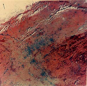
Europe, the Mediterranean, and North Africa have been the cultural center of Western Civilization since the eras of the Sumerians, Egyptians, Greeks, and Romans. Although Iceland is considered to be within the sphere of Europe, for most traveling from the U.S. this center of our Western roots and culture begins in Ireland and ends to the east at Moscow. The majority of the continent is moderately vegetated - much land has been cultivated now but forests remain.
Europe I
(Note 1: This page is image intensive [slow downloading], so it has been split into two pages.)
(Note 2: Some of the images below were provided by ESA’s Eduspace. Additional images can be found at their Eduspace links site.
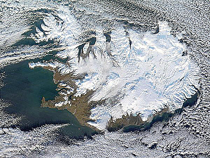
It may come as a surprise to learn that many geographers consider Iceland to be a part of an extended Europe. It was settled by Europeans centuries ago and still has Danish roots. But, geolgoically, Iceland lies at the plate boundary of the Eurasian tectonic plate. It sits atop one of the few places where the Atlantic Ridge, a divergent spreading zone of volcanic origin, extends above the surface. Take a look at this MODIS image of the island which, in midwinter, has a greater snow cover that in the summer months (but some of the white is a permanent icecap, shown again on page 17-5).
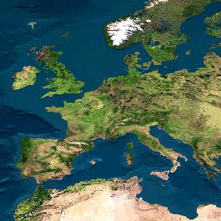
Most of us are familiar with the shape of Europe and its surrounding regions from our geography lessons since our grade school days. Now here is what that continent (continuous with, but arbitrarily separated from, Asia) as seen from space:
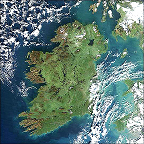
As we cross the Atlantic Ocean, the first land we might see if enroute to, say, London is the “Emerald Isle” so dear to every Irishman. This next scene has been colored green by projecting the MSS Band 7 image through a green rather than red filter). The upper part of the island is Northern Ireland, with Belfast appearing here in a reddish tone, at the end of the Belfast Lough (actually, a marine bay). The large inland lake to the west is Lough Neagh; to the east is the smaller Strangford Lough, with its outlet to the sea. In this June image, late spring, the Irish countryside is truly a rich green almost everywhere. The Republic of Ireland occupies the larger part of the land. The northern section of its capital, Dublin, shows also in reddish-purple, on the coast just at center bottom. The large island in the Irish Sea is the Isle of Man. The jutting land peninsula in center top is the tip of the Scottish mainland, at the Mull of Galloway.
Dublin on the Irish east coast is quite familiar to American Irish who journey back to the land of their forekin. The writer’s (NMS) fondest memory of this town is the Guinness Brewery whose tour ends in a tasting session. Here is Dublin as seen by SIR-C radar (Section 8):

Ireland has always been a favorite destination for Americans, many of Irish ancestry and others who seek its enchantment as tourists. The writer (not Irish), his wife (all Irish), and son (obviously half-Irish) went around the island in September of 2000. A must-see is the rugged west coast of the Republic of Ireland. A favorite of most visitors is the Ring of Kerry, which follows the coastline around the Iveragh Peninsula. in County Kerry. We accessed the Ring through the charming town of Killarney. This SIR-C radar image shows the entire Peninsula, with a hint of the hilly terrain that marks its interior:
One of the great cities of the world is London, shown here in this scene that covers part of southeast England. The Thames Estuary is conspicuous. The countryside, in this March 1973 image, has just begun to “green up” as field crops and grasslands resume growth. Besides greater London (near center; blue fringed with black), other well known smaller cities, among them Oxford and Reading, are discernible. The dark, vegetation-poor area in the upper right is East Anglia, whose rocky soils inhibit extensive farming. Through London itself passes the Prime Meridian (0°) for the global latitude-longitude coordinate system.

This ASTER image zeroes in on Greater London and surrounding countryside. The Parliament area shown two images down is near the center. The green areas to the west are St. James Park and Hyde Park.

London’s fame and its kinship to Americans’ heritage will prompt us to spend a bit more time in looking at some of its landmarks. Greater London’s area is among the largest in Europe. The image most of us conjure up when asked to visualize London will include the Parliament Building and Big Ben.

The Quickbird satellite has taken high resolution images of the Parliament buildings, the nearby bridge across the Thames, and the Jubilee Park rededicated in 2000 (Millenium Park) with its huge Ferris Wheel (400 ft high) known as the London Eye.

An enlargement, taken at another time, shows both the Parliament buildings and the great Wheel in a different orientation than above.

Much of the same area seen in these two space images is identified in this map:

See if you can find the following in the images: Parliament buildings and Westminster Abbey; St. James Park; Waterloo Station; Charing Cross Station; Her Majesty’s Treasury; St. Thomas Hospital. We show below a photo of perhaps the visual symbol of London, Big Ben and the Parliament buildings:
The north side of the Thames that includes the areas shown in the space imagery takes on a somewhat different perspective when seen as color aerial oblique photos as shown here:


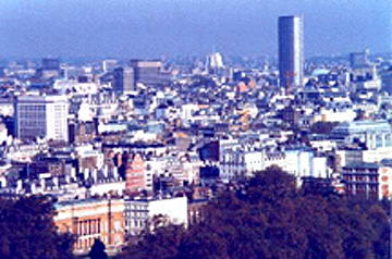
But, beyond the Thames and the government buildings, present day London is acquiring a modern look, with tall buildings (but few skyscrapers), thus:
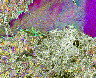
The biggest city in Scotland, the upper half of the British Isles, is Edinburgh (pronounced “Ed-in-buro”). This is an ERS-SAR view, somewhat enlarged. Note the blackish oval feature in from the right center. That is the famed “Arthur’s Seat”, which was a key aid to the Scot James Hutton who is credited as the one who laid the foundation of modern Geology. That hill, with its volcanic rocks, was just outside the writer’s door in the Edinburgh University’s guest villa as he attended a meeting of geomorphologists.
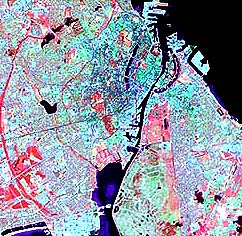
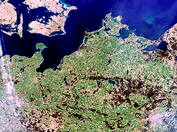
Across the North Sea from England and Scotland lies the northwestern part of the Netherlands, or Holland. The scene below reveals one of the great engineering feats by any nation. Much of the land was once under water or has been created by backfill. The great inland bodies of water were known as the Zuider Zee after they enlarged following breaches in the 13th century of the line of present day barrier islands known as the West Frisian Islands. In 1932 a 25 km (16 mile) barrier dam was completed to divide this water into the Wadden Zee (north) and Ijssell Meer (south). The change in flow facilitated drainage that resulted allowed landmasses such as Flevoland, known as polders; these show up a bluish-gray areas. Some of the many Dutch canals are visible. Amsterdam, Holland�s largest city (in black tones), lies along a major canal to the sea at the bottom of the silty Meer.
|The lowlands and polders of Holland |
Here is a closer look at Amsterdam, as seen by the ERS SAR radar.

The island of Zealand (Sjaelland) in Denmark dominates the next image. Copenhagen, that country�s capital, is the dark blackish area at it upper right (east) end. A narrow strait, the Ore Sund, separates this part of Denmark from southern Sweden; Malmo, one of that country�s larger cities, appears as another black spot. Farming dominates the land use in these sections of both nations, principal crops being wheat, potatoes, and animal fodder. In Sweden, the reddish area is a forested region known as the Smaland Plateau.
southern tip of Sweden.|
Up close and personal, the Copenhagen looks like this:
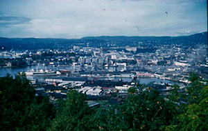
While we are presently in Scandinavia, lets look at two more capital cities. First is Oslo, Norway, seen here as a small blue patch at the end of a Baltic Sea inlet in this Landsat-2 subscene:

This ESA’s ERS-SAR close-up of Oslo gives a better sense of the low hilly topography around the city (white):

Oslo is a relatively small city (population about 750000) nestled in low mountains (the high mountains of Norway, with their fjords, are to the west). This view of the town was taken looking west from the Eckeberg Restaurant where I had lunch in 1960 with the most famed Russian geologist V.V. Beluossov.
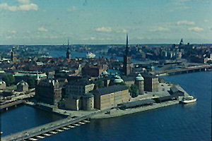
Next, a look at the inner city harbor of Stockholm, Sweden as seen by IKONOS, and then the equivalent area from an aerial oblique photo.

The industrial heartland of Germany dominates this next image. The famed Rhine River runs through the State of North Rhine-Westphalia. Numerous blotches of dark bluish-black mark the locations of many large cities (use an Atlas to pin these down). Along the Rhine are Bonn, Cologne, and Dusseldorf. The smaller Ruhr River, coming from the East, makes up the Ruhr Valley, with such cities as Duisburg, Essen, Bochum, and Dortmund whose steel and industrial works were the targets of many bombing raids by the Allies during World War 2. Much of the countryside is part of the North German Plains, where farming is the principal activity. The forested Central Uplands to the east blends into the Rothaar Gebirge. Small parts of Belgium and Holland lie along the left edge of the image.
We would like to add Berlin to our display of European capitals. An Envisat image does include this famous city, as a pink patch in the lower right, in a wide field image that covers much of northern Germany, eastern Denmark, and southern Sweden.
An ERS SAR image affords a closer look:

This IKONOS image shows the heart of Berlin:
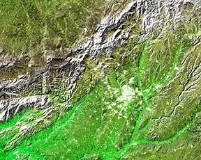
Much of northern Spain is dry with rainfall commonly less than 30 cm (12 inches). In this image, the wide Ebro Basin, drained by the Ebro River forms arid lowlands in which most of the agriculture (cereals; sugar beets) is concentrated along that river, tributaries, and irrigation ditches. Away from these farms, sheep grazing is conducted where grasses grow. The city of Zaragosa is evidenced by a blue patch in from the right center edge. Low blocks of hills and mountains run northwest through the picture. The southern edge of the Sierra de Guara, which rises to more than 2000 m (6000 ft), is at the top.
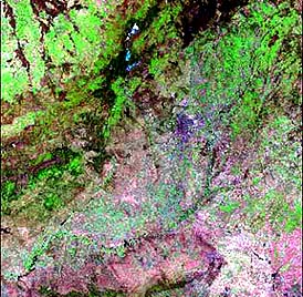
Vegetation increases somewhat as one moves into central Spain. This C-Band SRTM radar images shows Madrid and its surroundings:
The Madrid area appears in this colorful rendition using SWIR bands on Landsat-4. The city itself is hard to pick out in terms of a sharp boundary, but the mountains in the SRTM image are in the upper left of this image:
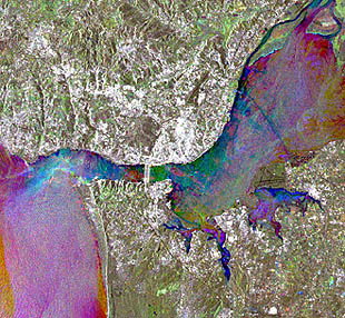
On the western side of the Iberian Peninsula is Portugal, whose capital is Lisbon. It lies on the northwest side of a bay created by the Rio de Tejo (Tagus River). This area is shown first as a Landsat-4 subscene and then as an ERS SAR scene.

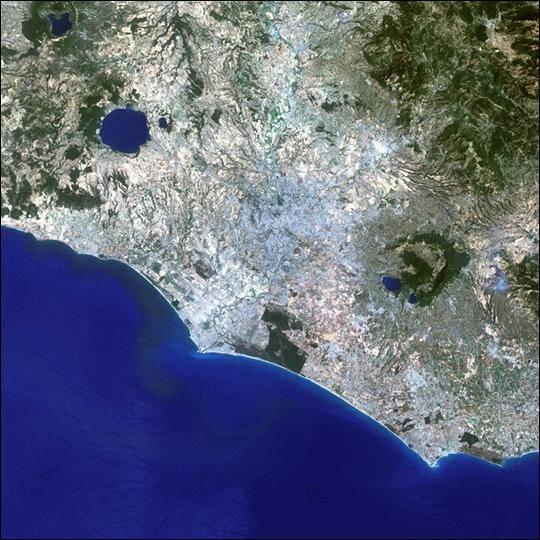
Rome, the capital of modern Italy and of the Great Roman Empire of the late pre- and early-Christian eras, is visible as a large bluish-black blotch in from the center left of this Landsat-1 image, lying about 30 km (20 miles) from the Tyrrhenian Sea at the port of Ostia. Rome is astride lowlands that, to the east, are up against the spine of Italy, the Apennine Mountains, which here are partly snow-covered in February. The view extends entirely across the peninsula, as just a tiny part of the Adriatic Sea occupies the upper right corner. The Eternal City lies midway between two ancient volcanoes, the Sabatini caldera, water-filled with Lago di Bracciano to the northwest, and the Latian volcano to the southeast with its small lake along which Castel Gondolfo, the summer home of the Popes, is located.

A closer look at Latium, the province of Rome when it was a Republic, and Rome itself, extending to the sea at Ostia, is given in this Landsat-7 ETM+ image.
Because of the great historical significance of Rome - although Athens may be considered the Cradle of Western Civilization, Rome is where not only hellenistic culture, but laws, great engineering feats, and the eventual center of pre-Byzantine Christianity all extended great influence on modern life - we will show several additional space and ground/aerial images to give you a better insight into this famed city. The first was taken by ESA’s PROBA satellite.

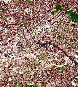
First, let’s look into ancient (plus modern) Rome itself. This next image was taken by the IKONOS 4 meter resolution camera, and shows central Rome. Near the image center is the Rome of the Empire, with its cluster of famous buildings on the Seven Hills (including several forums, baths, the Pantheon, the Circus Maximus). The large buildings are on the Palantine Hill. Most conspicuous in the image is the great Coliseum (oval building)
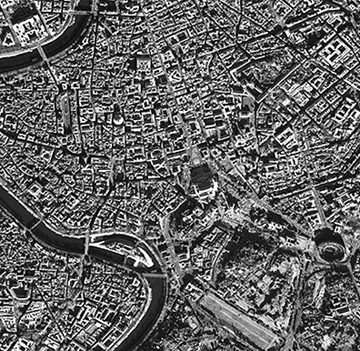
This general map of central Rome should help you to search for several of the famed landmarks of this great city:

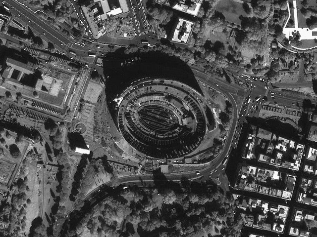
The scene below zeros in on this colossal Roman Coliseum (well known to those who saw the movie “Gladiator”). In this IKONOS (Space Imaging Corp.) black and white image, autos in the modern world can be picked out but the sensor lacks the time device that could picture ancient lions on the floor of the Coliseum.
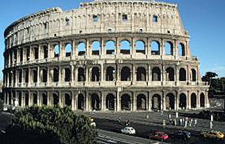
Much of this building survives today, as evident in this ground photo:
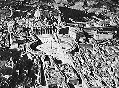
A must-see part of Rome actually isn’t a legal segment of the city. The Vatican is a small (109 acres) enclave west of central Rome that is the smallest independent state in the world, i.e., techically is not part of Italy even though embedded in Rome. Here is a view of St. Peter, the world’s largest church, with its two curved arms that embrace the huge square before it.
With that as a landmark, try in this next aerial shot to locate the church, and the part of Rome that lies to its northeast. The large wooded area is a park known as the Villa Borghese. Try to find the circular Castel Sant’ Angelo just off the Tiber River, where Tosca took her final leap in Puccini’s opera of the same name.

(Europe continues on the next page.)