Poyang Lake is the largest freshwater lake in China, and it plays an important role in flood control regulation and storage and biodiversity protection. Chlorophyll-a concentration levels in the water can reflect the primary productivity status, and it is also an important indicator to evaluate the degree of eutrophication. Remote sensing technology is conducive to the chlorophyll-a concentration monitoring of Poyang Lake, and has the advantages of covering a wide range, low cost, and ease of long-term dynamic monitoring.
Data
The water quality experimental data was collected and analyzed by the staff of the Poyang Lake Wetland Observation and Research Station of the Nanjing Institute of Geography & Limnology, Chinese Academy of Sciences. The water samples were collected on the spot and pretreated on the ship. After the lake test, the samples were taken back to the laboratory for analysis and determination, and the chlorophyll a concentration was measured. There were three instances when water quality sampling and synchronized water spectra measurements were conducted: in October 2011, July 2012, and October 2012. The geographic location and altitude information of the corresponding sampling sites was recorded.
Method
Inversion models of each of the seasonal chlorophyll-a concentration data from 2009 to 2012 in Poyang Lake were built by a semi-empirical method. A chlorophyll-a sensitive band range was determined based on analysis of spectral characteristics of the water body. According to the regression analysis between the reflectivity of Moderate Resolution Imaging Spectroradiometer (MODIS) channels in the sensitive zone and the measured chlorophyll-a concentration, a relationship between chlorophyll-a concentration and spectral indices consisting of various combinations of MODIS data bands can be built by seasonal quarters (January represents winter, April represents spring, July represents summer, and October represents autumn). The models that have a maximum coefficient of determination and minimum root-mean-square error were chosen as the inversion models of chlorophyll-a concentration.
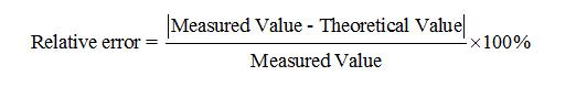
The MODIS remote sensing data and the independent measured data were used to verify the accuracy of inversion models. The relative error was used to measure the effectiveness of the models:
Results
The verification results showed that the dataset was reliable, and the analysis revealed that the chlorophyll-a concentration in Poyang Lake increased slowly from 2009 to 2012 [8]. The lowest annual chlorophyll-a concentration occurred from December to February, then rapidly rose to peak from March to July, and declined from August to November. In terms of spatial distribution, the highest areas of chlorophyll-a concentrations were located in the coastal waters and five river estuary areas. The higher the concentration that was observed, the more significantly the spatial characteristics changed.
The varied temporal and spatial characteristics of chlorophyll-a concentrations in Poyang Lake were the result of the combined effects of lake nutritional conditions, water temperature, water level changes, storms, and human activities. The temporal variation was mainly affected by natural factors such as changes in water area, while the differences in spatial distribution were predominantly influenced by ship traffic, sand mining, and agricultural activities in the surrounding areas.
Comment list ( 0 )

